
In this post we are receving signals from space! We will use RTL-SDR Blog V3 with dipole antenna to receive from a NOAA satellite. We will utilize SDR++ and SatDump applications to process the data. N2YO is a good website with a lot of information on satellites. It gives us information on when to start receiving.
NOAA-19 Satellite
Satellite orbits are classified by their distance from the Earth’s surface: LEO (low earth orbit, 160–2000 km), MEO (medium earth orbit, 2000–20000 km), and GEO (geostationary earth orbit, 35786 km). NOAA satellites are transmitting images 24/7, and the image you receive is a real-time image of your location. What is good with NOAA satellites is that there is no need for a official receiver or decoder, all you need is a cheap SDR and antennna. NOAA-19 is the fifth in a series of five Polar-orbiting Operational Environmental Satellites (POES) with advanced microwave sounding instruments that provide imaging and sounding capabilities. It circles 850 km above Earth and completes a revolution every 102 minutes.
N2YO Website
NOAA satellites can be received several times a day. To track the satellites, we will refer to N2YO website since it contains all the information about passes of NOAA-19 satellite. It gives 10-day predictions for satellites, too. So, you can decide when to receive.
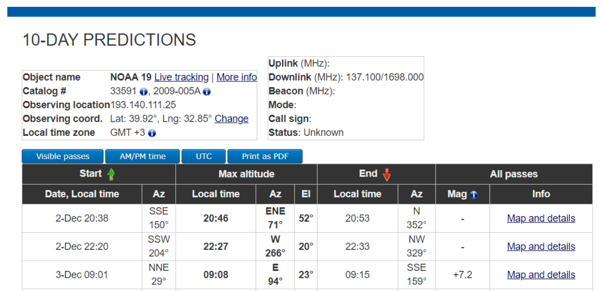 If you click on
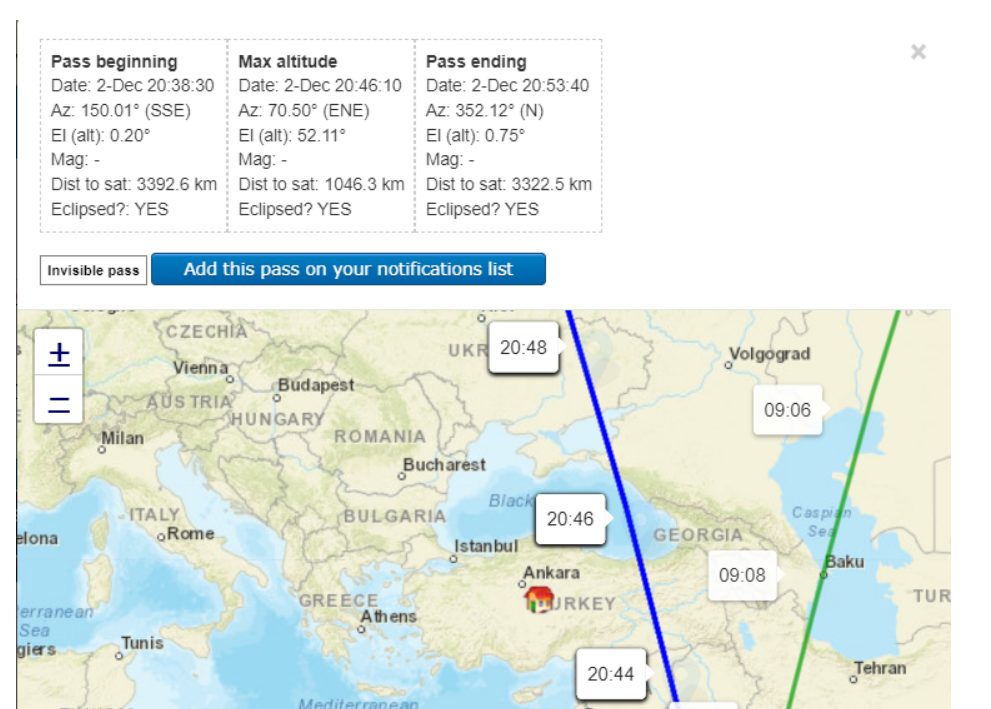
 Map and details link, you can find the satellite on a map with pass beginning and ending times.
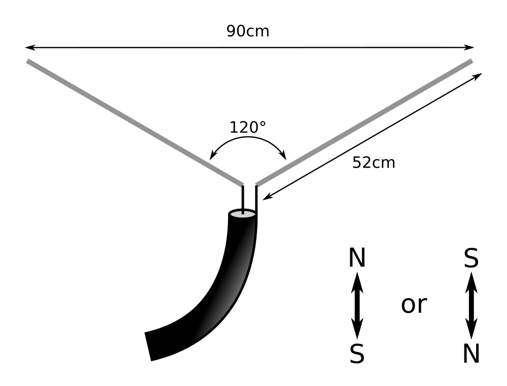
V-Dipole Antenna Configuration
For a proper antenna configuration, we followed Martin Bernardi's guide. We need a V-dipole antenna, consists of two elements of 52cm, spread apart by 120 degrees.
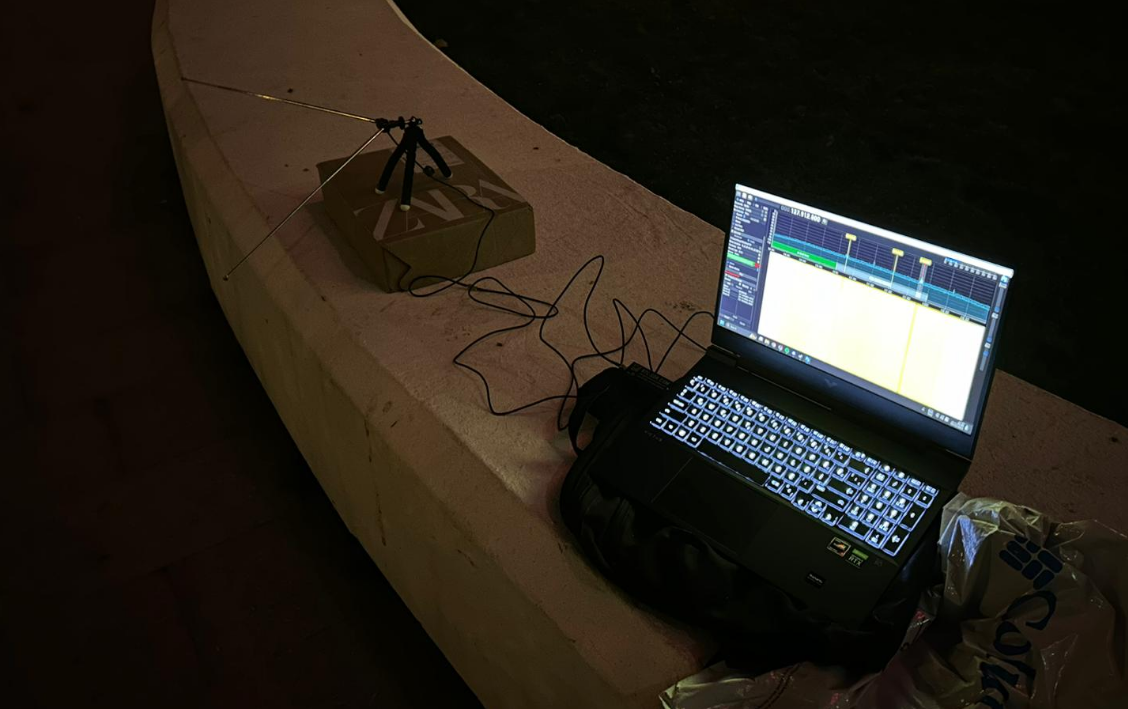
Using SDR++ to Receive
We are ready to receive the image signal! For this purpose we are using SDR++ general purpose SDR application. We tune to 137.1MHz, apply gain, select WBFM demodulation, set bandwidth around 50kHz. Next we start recording a wav file on 20:46. We stop recording when the signal disappears.
Post-processing with SatDump
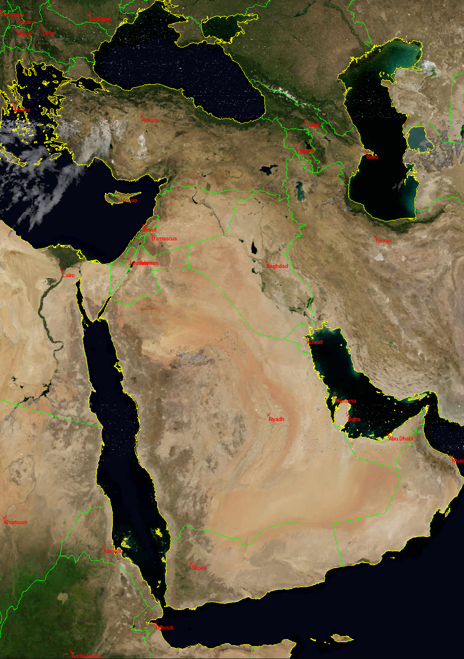
NOAA images are upside down 50% of the time, that’s because the satellites sometimes go from south to north and sometimes fron north to south. The images are black and white and they do not have map lines (divisions between countries, states, or coastlines). If you want to see the images in color with lines, we need a tool to post-process. We used SatDump to get attractive images. SatDump is a general purpose satellite data processing software. It also supports live decoding.